|
A pool of cold air over the British Isles
due to high pressure. A very slow moving Occluded front started to move in
from the south-west this caused a squeeze in the isobars and a resulting
easterly gale set in. The snow resulted in snow drifts of between 3 &
8 metres (10-26 feet) high. By the 22nd, milder air from the Atlantic had
replaced the cold easterlies and there was a general thaw. Without a doubt
this slow-moving front produced one of Britain's memorable blizzards
comparable with those of 1963, 1947, 1891 and 1881. One major difference
between 1891 and 1978 was that Cornwall escaped this time, being in the
warmer air. |
| 8MM FILM
IMAGES OF
THE SNOW AROUND BRADNINCH |
| HIGH STREET |
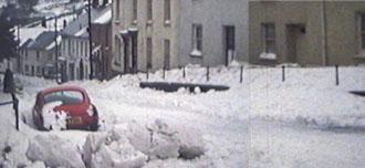 |
| Only one car down high
street. Now in 2001 there is 20+ cars down this street. |
| FORE STREET |
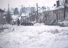 |
| Looking down Fore Street from
the centre of the Town. This car was trying to turn around. |
| SCHOOL- CANTEEN |
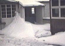 |
| Snow blown up around doorway
to the canteen building at the School |
| SLEDGING |
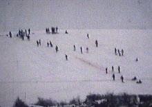 |
| Sledging in the field below
the cricket field |
| WESTFIELD |
 |
| Looking up through Westfield |
| HELE ROAD |
|
Move across photo below to look
down towards Hele from the same position on the road. |
|
|
|
|
|
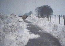
Looking towards Bradninch. There
was only a narrow piece of road cut out of the deep snow with the
digger on the right. |
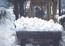
Digger cutting the snow of the
road from Bradninch to Hele. |
|
|
|
|
|
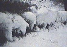
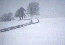
The tongue of snow coming out of
this gate shows that the wind was coming from the east. |
Snow coming through the
hedge |
|
| HIGHER HILL (Hele Payne) |
 |
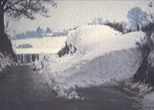
| This it the top of Higher
hill showing that the snow completely covered this road from hedge to
hedge. The road at this point is 8 feet below the top of the hedge. |
| HOPED YOU ENJOYED LOOKING
AT THE PHOTOS OF THE BLIZZARD OF '78
The images of the Blizzard of 1978 was supplied by the
late Mr. Gay of Westfield
|