![]()
LIGHTNING IMAGES FROM THE STORMS OF THE 17TH MAY, 2002
THIS PAGE MAY TAKE 5 MINUTES TO LOAD!
Sometimes when a page takes a long time to load it bypasses some of the images and leaves a x box instead - if this happens just hit the refresh button on your browser
These storms developed within half an hour from 03:30 on the 17th in the English Channel and move north eastwards. The storms developed ahead of a cold front moving erratically north eastwards. Warm air ahead of the front caused these storms to develop in the early hours. The storms contained manly CG'S with only the odd CC strikes. I observed many strikes across Exeter and the mid-Devon area.
IMAGES & PHOTOS FROM CASEBERRY HILL ABOVE BRADNINCH 236 Metres above sea level. Grid ref - 3.273 Long 50.493 Lat.
MOSTLY CLOUD TO GROUND STRIKES
|
35MM SCANNED IN PHOTOS BELOW |
|
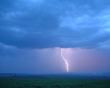
TIME APPROX 04:10 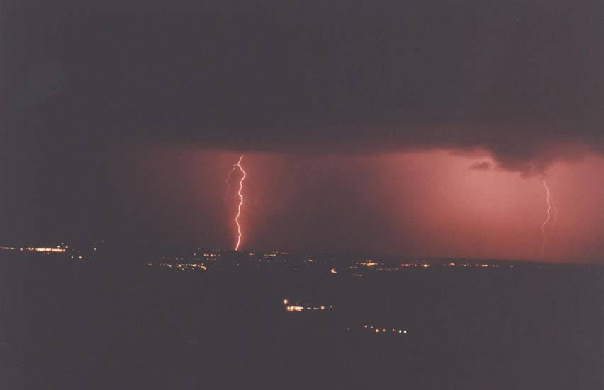
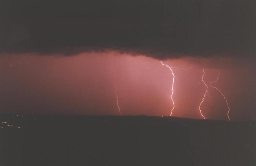
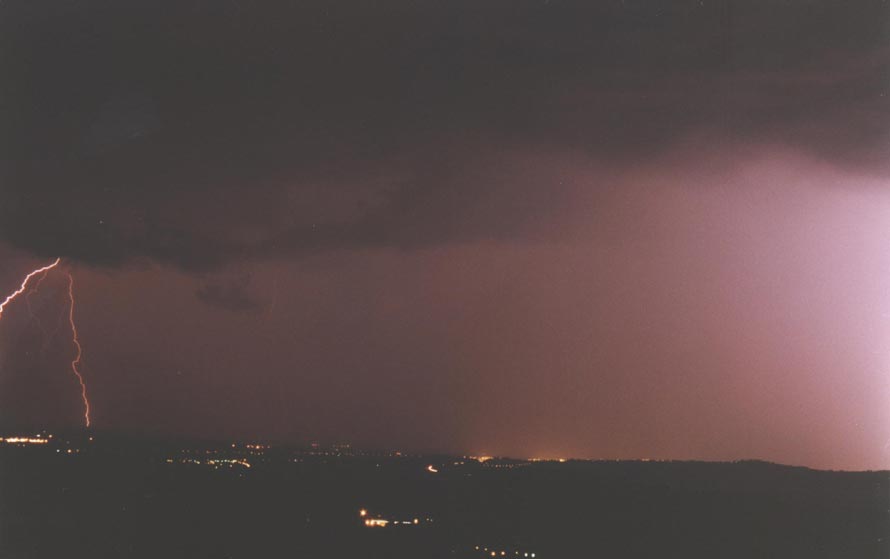
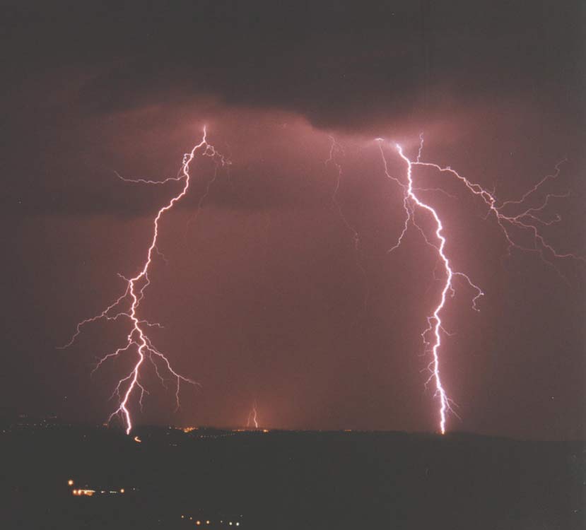
Explanation of lights an what you are looking at: The row of lights to the left centre is Exeter Airport, Broadclyst is the next row of lights to the right of the Airport, The row of lights to the right are the houses at Park Lane on the hill at Pinhoe. The lights to bottom centre is Silverton Mill.
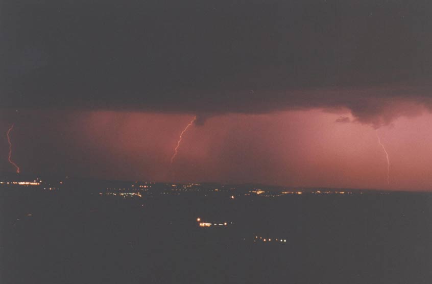
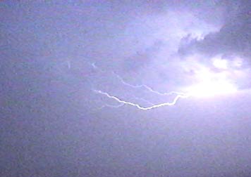
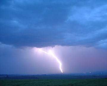
I moved the camera more to the right for this on above and below to cover Pinhoe to Stoke Cannon. The shutter was left open for about 90 sec to capture these build up of strikes. You can make out the ragged front edge to the storm heading across Exeter.
Back looking towards Broadclyst below
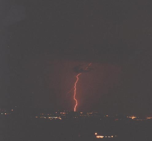
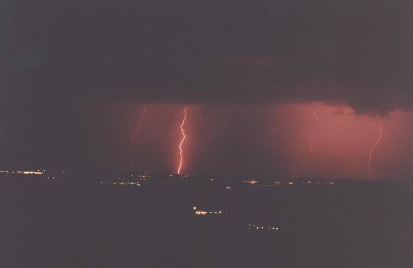
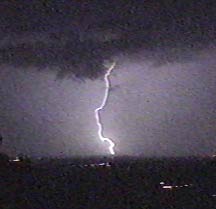
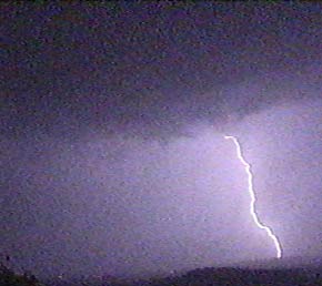
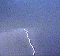
Strike on the Sowton area of Exeter
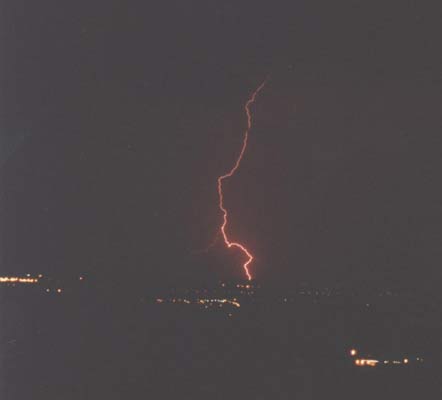
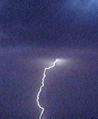
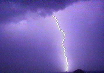
Pinhoe Strike
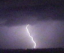
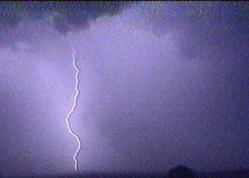
Just missed this on to the right but caught on on the left
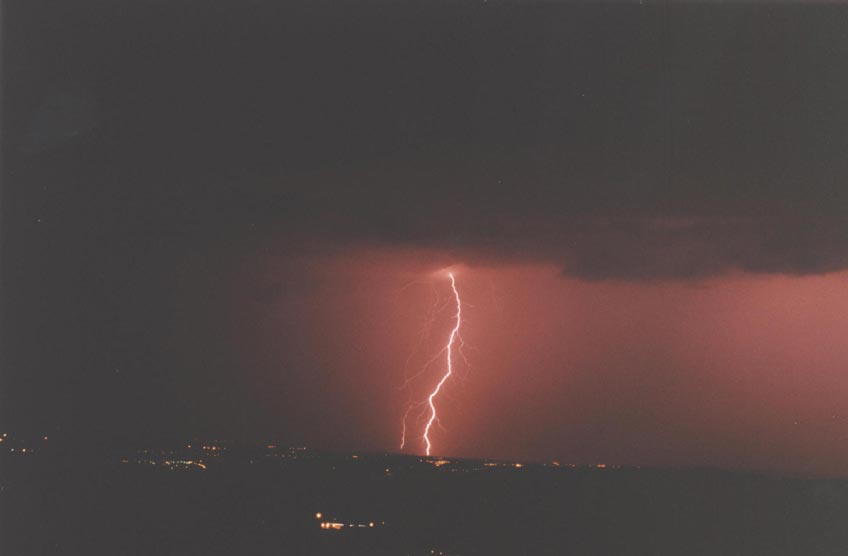
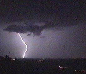
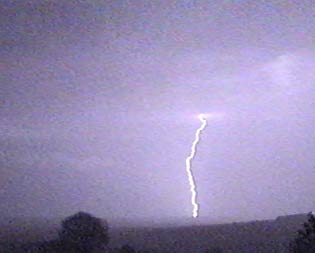
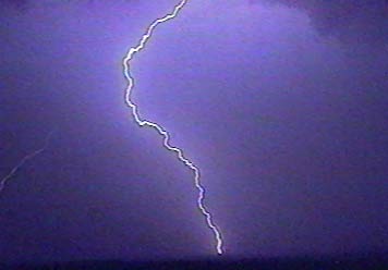
This CG hit behind Killerton near to Poltimore
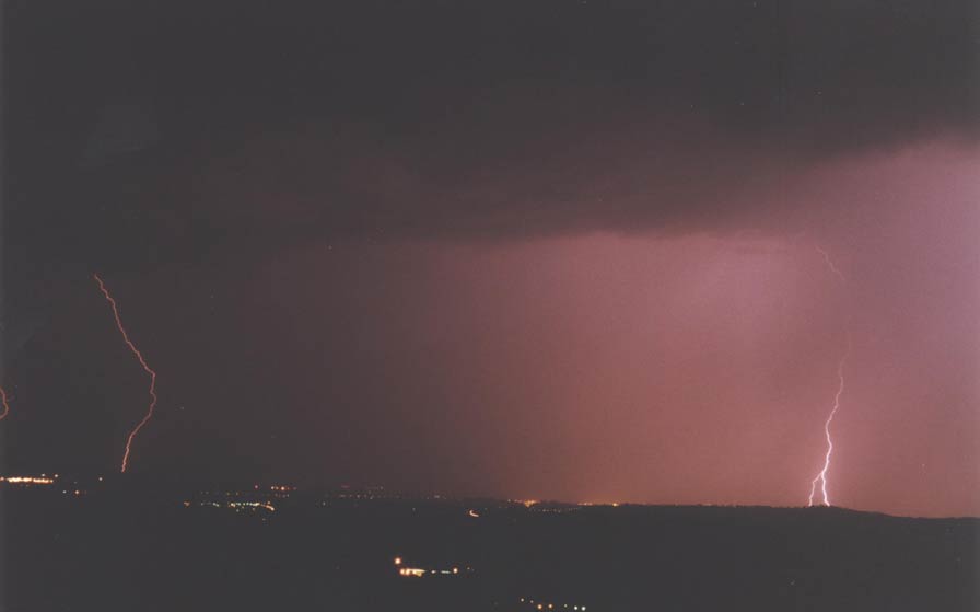
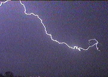
Strike on Sowton area (left) again and transmitter? in the Pennsylvania area of Exeter.
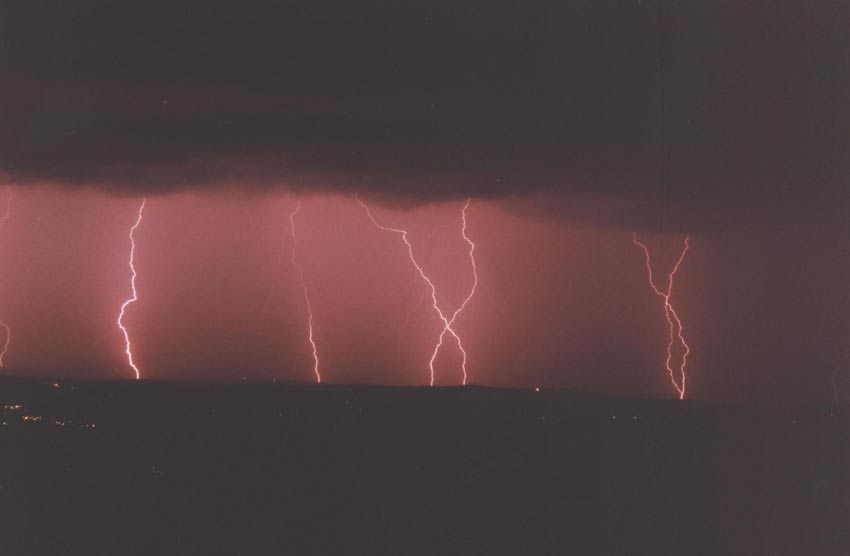
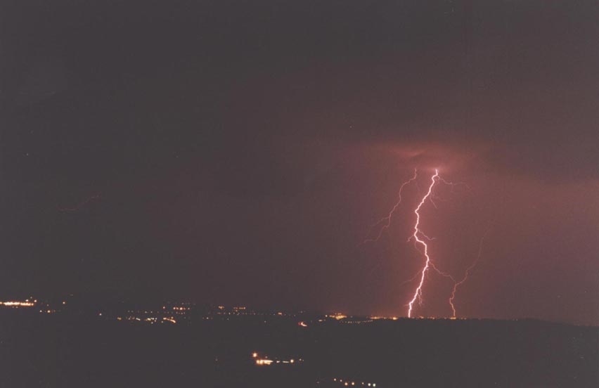
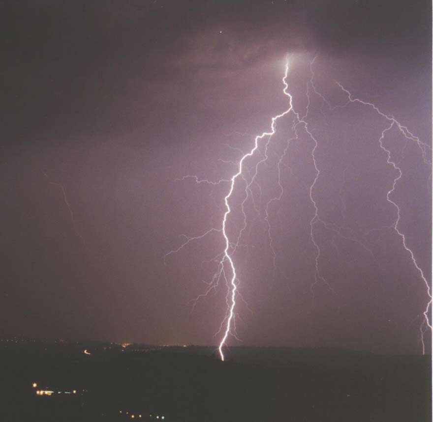
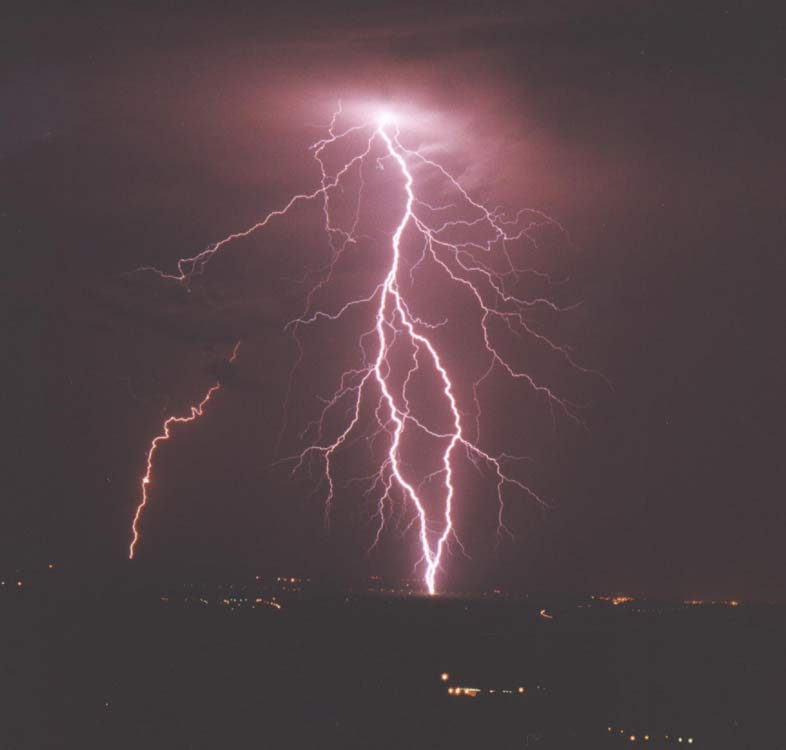
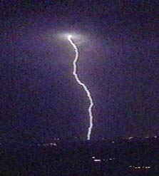
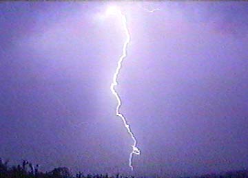
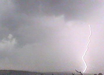
This was my best one of the night. A spectacular branched CG strike on pylons near to Clyst Honiton. This one was put in the Mid-Devon Gazette newspaper.
After this photo I decided that it was to risky to stay at this point any longer.
ALL THE ABOVE PHOTOS ARE AVAILABLE TO BUY AT HIGH RESOLUTION. PLEASE EMAIL TO REQUEST
VIDEO IMAGES BELOW
Same observation point to start with and then a move into barn.
I've now changed locations to a metal barn at the Beacon, Bradninch. as it was to risky to stay exposed on the hilltop where I was before.
TIME 04:45 APPROX
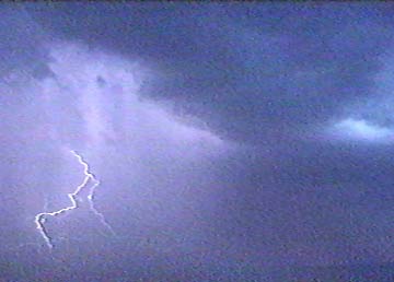
Not many of these during this storm a rare CC strike
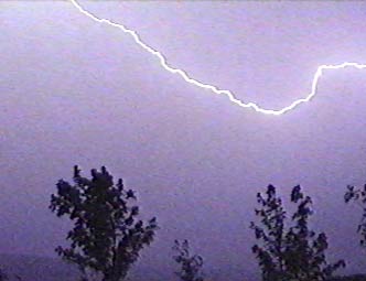
Looking towards Exeter
TIME 04:52
At this point Bradninch had a power cut
Another 2 CC's nearly overhead
VERY NEAR POSSIBLE GROUND STREAMER
The 3 images below follow each other. A- Shows a branched leader coming from storm. To the bottom of the image it shows a possible streamer coming off the gate about 50m away, this didn't connect with the cloud leader so there was no return stroke here - luckily. The return stroke (C) was near to Clyst Hydon. This was a new cell on the back edge of the first storm.
A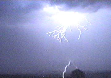
B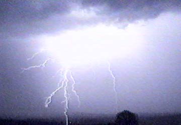
C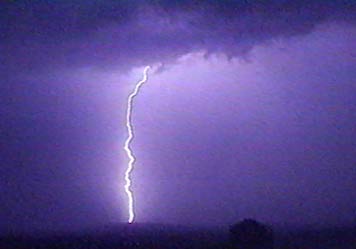
|
ANIMATION OF ABOVE POSSIBLE STREAMER |
|
|
|
This is the animation of the 9 frames off the video that complete the strike. The first one is a blank black one that I have added as a starting point. The next 2 (A & B above) I have slowed down to show streamers?. |
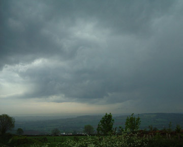
Getting light now and cast cumulus and rain fall streaks becoming visible
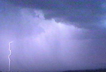
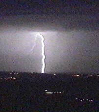
I was on the edge of this new cell with the ragged edge cloud to the storm overhead. Another CG near to Clyst Hydon (many pylons there) again.
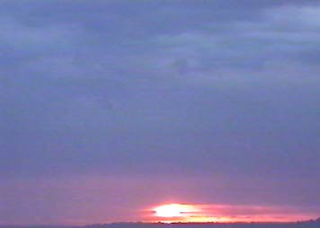
THE SUN
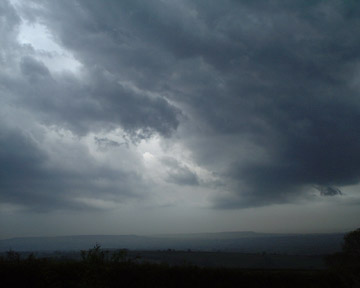
Somerset stayed clear of the storms so the sun was able to shine through under the storm
DIGITAL PHOTOS BELOW
Storms moving away to the north with the excellent sunrise following. There was still CG's with this sunrise but was not able to get any at this point unless they are on the 35mm film that I have not had developed yet.
TIME 05:14
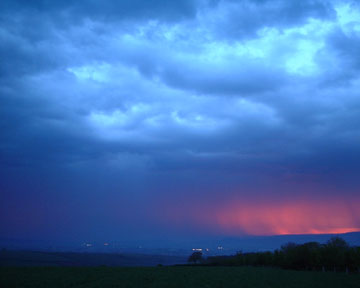
Looking towards Willand
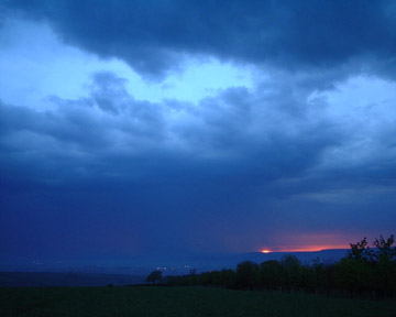
Just clicked my digital camera just in time to get these next 2 photos. This one below was put in the Express & Echo newspaper (Exeter local paper) on the 17th. TIME 05:16
Looking towards Tiverton
OTHER PHOTOS/IMAGES FROM STORMS AT 11AM
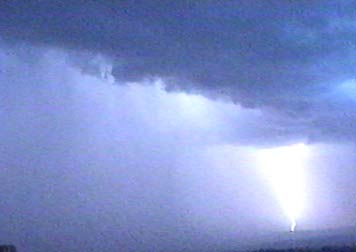
After 3 hours of quieter conditions more storms moved in from the south. These were not as severe as the ones earlier in the day (above).
TIME AROUND 13:00
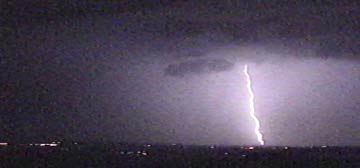
Exeter being hit again
Bradninch stayed in the dry line for about 1 hour while Exeter had a deluge during this time. Below 2 photos show the cast cumulus front edge to the storm.
These ragged clouds developed into new storm cells on the rear of the main storm
THERE WAS 28,000 STRIKES RECORDED IN THE 21 HOUR PERIOD FROM 00:00 IN A 300 MILE RADIUS OF BRADNINCH
OTHER LINKS FOR 17TH MAY STORMS

